By MICHAEL CRIMMINS
Glasgow News 1
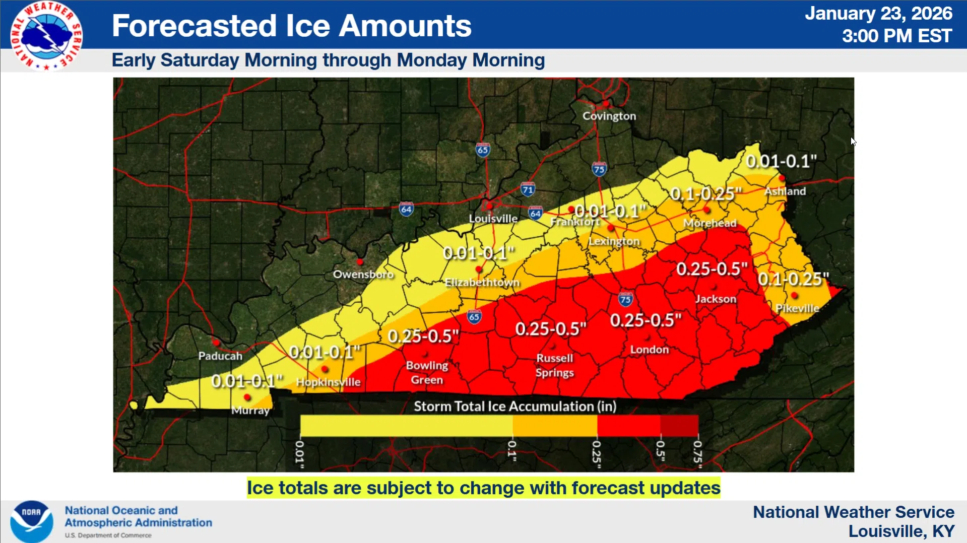
Emergency travel only this weekend was the advice from the meteorologists at the National Weather Service, who gave an updated weather forecast via conference call at 2 p.m. on Jan. 23.
With high confidence, Mike Kochasic with the National Weather Service said the wintry weather is expected to begin between 8 a.m. and 11 a.m. with snow possibly accumulating up to an inch per hour. From early Saturday morning through Monday morning Barren County is predicted to get 3 to 4 inches in the south and 6 to 8 inches in the north.
“We’re still expecting those major impacts,” Kochasic said. “We’re talking large snow and ice amounts, major impacts on the roadways, utilities [and] just daily life in general.”
“This will impact you in some way, form or fashion this weekend,” he added.
People should be prepared for power outages and impassable roads, Kochasic said.
Barren County is expected to get a 0.25 to a 0.5 inch of ice, according to information provided to Glasgow News 1 by the National Weather Service. Barren County Emergency Management Director Garland Gilliam previously said his “big concern” was the ice totals.
“When we’re talking about utilities and powerlines…we’re going to start losing some service lines going to houses,” Gilliam said previously. “You get much over a quarter-inch of ice and we start having major outages. An inch of ice is about an extra 500 pounds on a line, so…we’ll want to stay at or below that quarter-inch [threshold]. Even at a quarter-inch we’ll have some outages.”
Kochasic urged people to prepare for the weather even though the prep window is closing rapidly, and to “be good neighbors.”
Emergency preparedness tips from Emergency Management Director Garland Gilliam can be read here.
Comments