By JAMES BROWN
Glasgow News 1
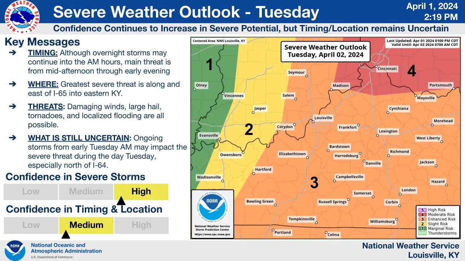
The National Weather Service in Louisville has issued a hazardous weather outlook that includes most of Kentucky, including Barren County and surrounding areas.
In the outlook released Monday afternoon, the weather service stated: “A few strong to severe storms will be possible through this evening, but better chances for storms and heavy rain will arrive after
midnight tonight. Damaging winds and large hail are possible, and storms later tonight could also produce spin-up tornadoes.”
The outlook area stretches from southern Indiana to Scottsville in southern Kentucky and includes all areas between.
“Strong to severe storms are likely Tuesday, with damaging winds, large hail, and tornadoes all possible. Multiple rounds of thunderstorms may lead to localized flash flooding, especially later in the day on Tuesday,” the weather service also stated.
“Storms this evening will move from west to east around 40 mph,” the service also stated.
Find below a list of safe rooms in Barren County and contact information for Barren County Emergency Management.
Barren County Emergency Management can be contacted at 270-651-4910 or 270-629-5933.
• South Barren Volunteer Fire Department Station 2 (on Bishop Road) at 6200 Old Bowling Green Road in Glasgow
• East Barren Volunteer Fire Department at 761 Hollis Thomas Road in Glasgow
• South Barren Volunteer Fire Department Station 1 at 197 Steam Mill Road in Smiths Grove
• Haywood Volunteer Fire Department at 67 Matthews Mill Road in Glasgow
• Temple Hill Volunteer Fire Department Station 2 at 7694 Roseville Road in Glasgow
• Temple Hill Volunteer Fire Department Station 1 at 8543 Tompkinsville Road in Glasgow
• Hiseville Volunteer Fire Department Station 2 at 728 Tick Ridge Road in Glasgow
• Park City Volunteer Fire Department at 24410 Louisville Road in Park City
• Cave City’s Doyle Park at 111 Reynolds Street in Cave City
• Cave City’s Public Works Department at 405 Wall Street in Cave City
Comments